Sunday, September 8, 2013

Eastern Townships 2013, Day 1: Montreal to Ange-Gardien

Over the course of the year, the Biketopus and I had loosely talked about doing a long bike tour this summer. The Biketopus will start a busy new job next year and so we wanted to take the opportunity to be on the road for more than just a few days. We discussed various options -- taking the bikes on our France work/vacation trip, touring in my native Germany, or maybe going out to the US West Coast. In the end, we decided to stay close to home: start in Montreal and go east for about two weeks, taking the Route Verte 1 to Quebec City, continuing along the Saint Lawrence, and then cutting across the Gaspesie peninsula. Unfortunately, we had a family emergency just before the planned start of the tour and therefore had to modify our plans. The trip was trimmed down to one week and about 600km of riding in a loop from Montreal.


I planned the route using my local knowledge of the region, gained on my long solo rides and brevets, the Route Verte guidebook, and the Strava global heatmap. I knew that 600km in one week would be pushing it, especially if you keep in mind that as a rule of thumb you have to add about 10% distance in order to get a realistic estimate. But since the last part of the ride would be in well-known territory I knew that I could always come up with a shortcut if necessary.

Preparation for the ride was a bit hectic. As per usual, Wolfgang, my trusty Surly Cross-Check, would be carrying most of the gear, and as I had recently switched out the fork to a disc-brake compatible one, I had to install a new front rack, a Tubus Tara. Other than that and switching one of Wolfgang's badly worn tires, both our bikes were in pretty good shape. The night before our departure, we finished packing all our gear, and on Friday morning it was time to load up. Wolfgang was burdened with two Ortlieb Front Rollers, my recently acquired Back Roller Pluses, the REI Half Dome Plus tent, and a little army surplus handlebar bag. All together, bike and gear weighed in at about 39kg, if our luggage scale is to be trusted. Madge, the Biketopus's Fuji Touring, had one rear pannier and the classic Thermarest on the rack.

All the preparation paid off, and on Friday morning, at 9:30 we left home -- even half an hour earlier than planned! Originally, the first stage of the ride would have led us almost to Granby, but since one of the campgrounds there was full and the other one didn't have potable water(?!), we aimed for a campground near Ange-Gardien.

At the request of the Biketopus, we left the island of Montreal via the Champlain Bridge Ice Control Structure (Estacade) and were then planning to get to the South Shore at the Saint-Lambert locks. Unfortunately, a big ship was just about to enter the locks, which would have meant at least a 30 minute delay. Instead, we decided to detour via the Jacques Cartier Bridge, adding a few kilometers and, more importantly, the first steep climb of our trip. Pushing Wolfgang up that incline was a sharp reminder that I was no longer riding my 11-34 MTB cassette like on the last tour, but merely a 13-26. Oh well, too late.
Cockpit panda of Wolfgang and me

On the South Shore, we took our first little break on the Route Verte 1, which we would follow for the next 30km into Chambly -- a familiar route to both of us.

Time for a second breakfast
Wolfgang and Madge
The weather was glorious: a little humid, but clear blue skies, pleasant temperatures and nice tailwind.
After getting out of the suburbs, the nice riding begins

We got into the pretty town of Chambly just in time for lunch. Usually I ride through Chambly only on the weekends, when it is full of cyclists and other tourists; today, however, the many cafés and restaurants weren't very busy. We ate at Marius, which was maybe a little overpriced, but offered a terrace with a great view of Lac Chambly.

Before we got going again, I had to re-tighten Madge's handlebars. Unfortunately, somewhere in the process of packing up again, I left behind both my bike gloves and the padlock for our bikes -- something I realized only many kilometers further along.

After passing the first set of locks on the Chambly Canal, we left the Route Verte, crossed the Richelieu River and got onto the Route des Champs. This involves some confusing zig-zagging in the towns of Richelieu and Marieville, but also a newly paved stretch of road with wide bike lanes. The first half of the Route des Champs is on well-maintained gravel. As the name of the route implies, it leads mostly through fields and isn't particularly exciting.
Gravel portion of the Route des Champs
A happy Biketopus
In Saint-Cesaire, we stopped to get dinner ingredients and a new padlock. I made some fun of the biketopus of managing to spend 40 dollars at the supermarket, but I guess that's what happens if you go grocery shopping while hungry. To get to the campground, we had to leave the Route des Champs just after Saint-Cesaire, first on a nice country road, then for a short stretch on a busy highway with a narrow shoulder, and then again on a nice country road out of the village of Ange-Gardien.

The final stretch of the ride dragged on a little longer than expected and we re-checked Google Maps to make sure we were on the right track. Indeed, we were, and after the next turn Camping Mon Repos appeared. We were happy to see that their sign included a cyclist:
The campground itself was probably the largest one I've ever been to (not that that means much), and on first sight its primary audience were clearly not cyclists but seasonal campers with RVs and trailers. 
Three pools!

Not bike campers...
To get to our campsite, we had to ride over a kilometer to the outer edge of the campground. Once we got, there, however, we were pleasantly surprised: a huge grassy spot with fire pits and picnic tables, surrounded by trees. There was enough space for at least eight tents, but we had it all to ourselves!


Somewhat less pleasant was the fact that one had to pay for hot water in the showers. Not so much a problem for me, as I always shower cold anyway, but the Biketopus instead chose to just go for a swim in one of the three pools. After a big dinner and a couple of beers, we crawled into our sleeping bags and dozed off.


> continue to day 2


Wednesday, August 21, 2013

Tour de France 2013, Part 1: Marseille

As part of our summer work-vacation trip with the biketopus, I had a chance to see the 100th edition of the Tour de France. We managed to tweak our schedule so that I was able to see four stages, one in Marseille and three in and around Gap in the French High Alps. Lots of pictures were taken, and here is the first installment of photo essays.

Marseille was the finish of the fifth stage of the Tour. After three stages on Corsica and the team time trial in Nice, this stage was a mostly flat 228km from Cagnes-sur-Mer to the Marseille beaches.

Having never been to the Tour in person, I didn't have a good idea of what to expect -- how many people are going to be there? How close to the action can you get? What's the best place to be at? -- and therefore just made up things on the go. I knew that on such a flat stage there most likely would be a mass sprint at the finish and so I decided to head out to the finish area. Wanting to get a good spot, I headed out there on my Le Velo bike share bike several before the projected arrival.

Untitled
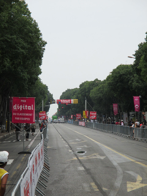
The roads were already closed to car traffic, and as I assumed they'd be closed for cyclists, too, I dropped off my bike and continued on foot along the Avenue du Prado.
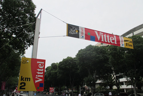
Two kilometers to go
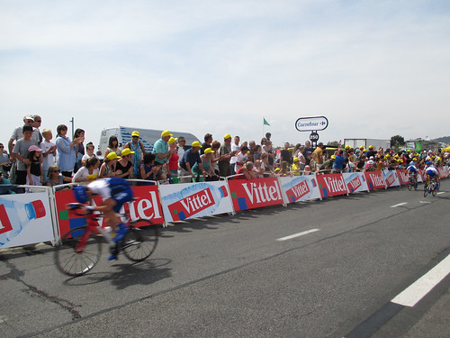
While walking along the wide street and past the 2 km mark a bunch of cyclists passed me on the closed-off section of the road -- I now regretted having dropped off my bike instead of also riding on the same road that the pro riders would soon be on.
Untitled
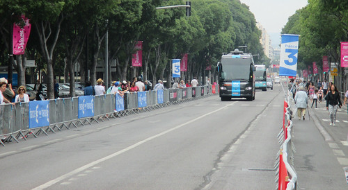
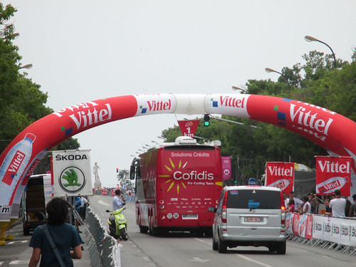
Soon after, the first team buses appeared.
Untitled
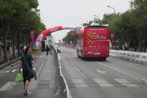
It was quite funny to watch...
Untitled 
... how carefully they navigated through "la flamme rouge", the marker for the final kilometer. On the very first stage of the Tour in Corsica, a team bus had crashed into the finish line, causing all kinds of complications.
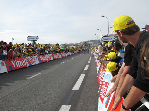
Untitled When I arrived at the final straightaway it was still pretty empty. I walked as far as I could, but access was restricted at the final 200 meter marker. I walked back a little bit and secured myself a nice front row spot at about 220 meters from the finish. Now the waiting began, as the riders wouldn't be arriving for another two hours.
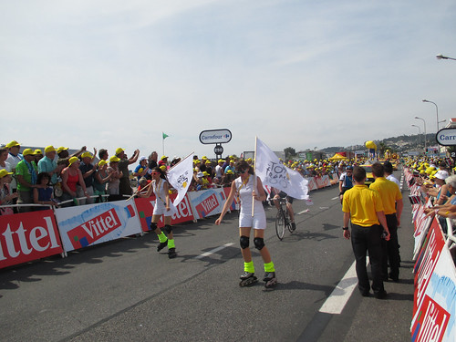
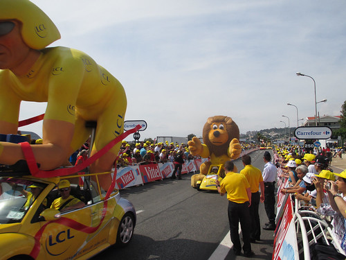
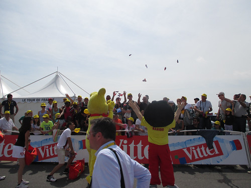
Untitled Fortunately, the Tour organizers try hard to keep spectators entertained, and that's what "La Caravane Publicitaire" is for. It's basically a big parade of all the main sponsors, giving away free crap.
Untitled The quality of the floats ranged from "well done and funny"...
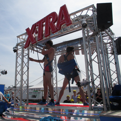
Untitled ...to "rather strange."
Untitled What was at least as much fun as watching the caravane itself, was watching how excited people would get over a free bottle of water, polyester hats, or a pack of candy. Raining Haribos!
Kids' race arriving After the caravane had come through, two groups of young riders came racing through. First the really young ones...
Untitled ... then the somewhat older ones sprinting it out.
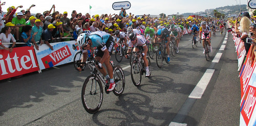
Here they come! The long waiting had taken its toll and I felt increasingly roasted under the Mediterranean sun, but finally the riders arrived! As expected, it was a mass sprint and as such it was over very quickly.
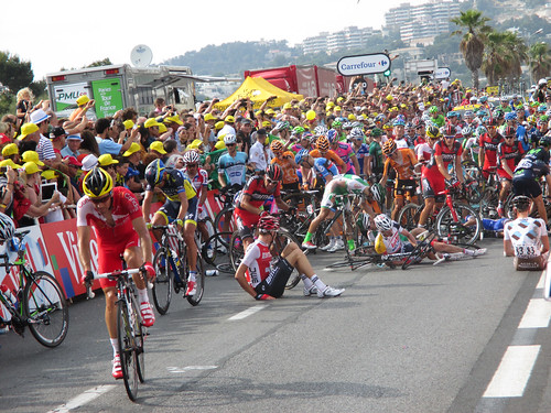
200 meters to go Going all out on the last 200 meters. At this point, Gert Steegmans was in front, but he was only doing the work for his team mate Mark Cavendish right behind him, who would eventually win this stage. If you zoom in on the picture you can see the big crash unfolding in the background.
Crash! The mass crash looked pretty bad at first, but it seems that nobody got hurt too badly -- which is kind of surprising, given how fast the riders must have been.
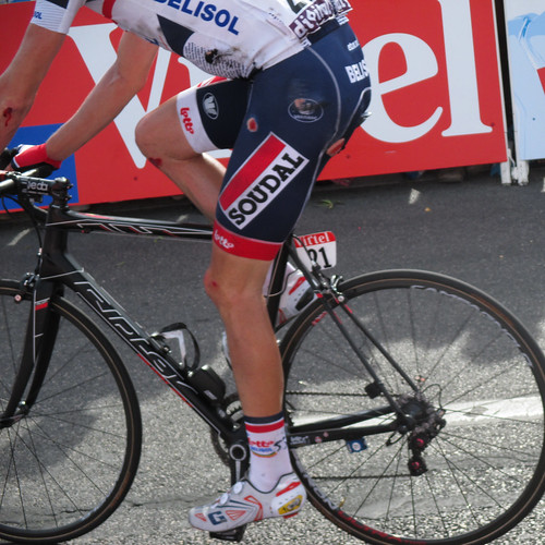
Ouch Scrapes and bruises, however, were plentiful. Ouch!

The next part of my Tour reports will follow soon.

Tuesday, August 6, 2013

Plan your bike rides with aggregated Strava data

Edit 2013-08-17: Please read the update at the end of the post.
Edit 2014-05-31: As this post appears to be getting a lot of search engine traffic, I'd like to point out that the functionality I'm describing here is now available much more comfortably as part of Strava itself. I guess I was not to only person intrigued by the concept.

Most people would not think of Strava as a planning tool. Sure, it's a great performance and training tracker and provides lots of opportunities to compete with fellow cyclists and yourself, but its use for route planning is less obvious.

The basic problem is this: You want to plan a ride in area that you don't know well. There are many roads, but how can you tell apart the heavily trafficked, narrow highway from the lovely scenic back road? There already are a number of tool that can help, but they all have some shortcomings. For the amount of traffic on a given road, one can look up traffic count data from state or local departments of transportation (e.g. New York State). Depending on your location, this works reasonably well for major roads, but the small back roads that are often the nicest to ride on often lack count data. Google Street View can give you a good general impression of a road -- how wide is it, does it have a shoulder, are there big potholes? -- but it can be tedious to check longer stretches of a road. OpenStreetMap allows everyone to add useful information to their geographic database, like the existence of shoulders, the smoothness of the road, or its speed limit; but so far a lot of those features are not displayed on the map and the data especially in North America is very incomplete.

Probably a nice road for cycling -- unless the road is only this empty on early Sunday mornings ... (Screenshot from Google Street View)


So wouldn't it be great if you could just ask a fellow cyclist what she thinks of the road in question? Or, as different cyclists have different preferences, if you could ask a hundred cyclists? Or a thousand? Well, why not just do that: Hundreds of thousands of athletes log their bike rides on the Strava website, and fortunately Strava provides an API that allows other applications to access that data. The folks at raceshape.com offer a number of different analysis tools, but for our purposes the "global heatmap" is the one that's most useful.

What the heatmap does is to basically accumulate all the GPS data from Strava and overlay it on a map, with the color of the tracks representing the number of times a road has been ridden on. If you look at Montreal, for example, you can very clearly see some of the most popular cycling routes: the Estacade across the St. Lawrence, the Lachine Canal bike path, or the various ways to climb and descend Mont Royal.

Screenshot from raceshape.com

 Just like the approaches described above, there are limitations to the global heatmap for ride planning as well: Less populated areas often don't have sufficient data to be displayed on the map. In addition, it's important to keep in mind that Strava is mostly used by road cyclists, evidenced by the fact that for example the very popular bike path along the Chambly Canal doesn't even appear on the map -- presumably because it has a gravel surface.

Some traces of activity on the two highways along the Richelieu River, but nothing on the bike path (Screenshot from raceshape.com)
That being said, my own experience with using the map for route planning has been very positive. It has allowed me to discover some great cycling roads -- and avoid some of the not-so-awesome ones.

Update: As Andy and Brian have pointed out in the comments, the data used for the global heatmap is more limited than I thought: Instead of representing all or even a large portion of Strava ride data, it is only a small subset of those Strava users who explicitly have allowed the raceshape website to access their data. And at the moment there isn't even a link on the raceshape homepage to do that. If you would like to have your data included and get your own personal heatmap, use this link.

Sunday, July 28, 2013

Ride report: An accidental 185km ride

I got back from France on Monday night and the jetlag and who knows what else made me feel quite miserable throughout the whole week. Whereas in France I wanted to ride all the time -- and couldn't, back in Montreal I could've ridden all the time -- but wouldn't. Since the lack of physical activity obviously didn't help with my mood, I firmly planned to go for a ride on Saturday. Nothing strenuous, just 100km at a leisurely on a well-known route.

Knowing myself and my tendency not to go through with the "leisurely pace" or "just 100km" aspects, I even took measures like leaving at home my GPS (to prevent me from chasing Strava segments), just bringing one water bottle, and not packing more than the four Clif Bars that were already in my saddle bag. The jetlag woke me up at 5:30 and I was on the road by 7:30, and initially everything worked out as planned. I tootled along across the St. Lawrence and on towards Chambly where I was then to turn towards St.-Jean-sur-Richelieu on the Chambly Canal bike path.

Once I got to a little map display of the region's bike trails in Chambly, however, I suddenly was like: "Hey, you've already done the St.-Jean ride a couple times this year. What about going to, say, Granby?" The map claimed it would only be 26 km, and while in the back of my mind I clearly knew that that couldn't be right, the urge to bikebikebike had already kicked in. I was thrown back a bit when just 5 minutes later I got stuck at the swing bridge across the Chambly Canal. It stayed open for quite some time, meaning that a sizeable number of cars and cyclists amassed on both ends.
Gunnar at the shore of Lac-Chambly

I was first in line when it opened and somehow the knowledge of having large packs of cyclists behind me made me drop that "ride leisurely" thing. Things got even "worse" when at a traffic light a roadie on a crabon wonder bike asked where I was going. He told me he was headed for Magog, which is past Granby, and that he, too, intended to take the main road instead of the bike path. Neither of us said anything about riding together, but soon I'd hear the sound of another bike sitting on my wheel. I was going fast now -- and enjoyed it. Soon we'd start taking turns with the pulls and with an average of well over 30 km/h we zoomed along on the wide shoulder of Route 112 towards Granby (which, by the way, is 48 km from Chambly, not 26...).

Lac-Boivin

After 35 km we started slowing down a bit and by the time we got to Granby both us felt pretty wasted and in need of a break. I had only had one Clif Bar and my water bottle wasn't even empty yet. A nice female triathlete we had been drafting for the last 2km (ouch, was she fast...) gave us some recommendations for places to eat at in Granby and pointed out that there was a huge classic car expo going on. I parted ways with my riding buddy -- I hope his legs weren't too toast, as Magog is still an hour from Granby and now the hills would start -- and went to a drug store to buy water, V8 and a bottle of sunscreen.

Lac-Boivin and its fountain
One of many crazy cars
I don't particularly care about cars but since the expo was just around the corner I rode in that direction anyway. Seeing all the crazy hot rods lined up was actually fun and I do appreciate the DIY and custom modification culture in that scene (more pics at the end of the post). Past the exhibition grounds, at an observation tower at Lac-Boivin, I finally took my well-deserved break and after feeling somewhat recovered I started heading back home. My odometer was at 92 km and I took it much more slowly now. Instead of riding on Route 112 I stayed on the Route-des-Champs trail all the way back to Chambly. My legs were tired and my butt increasingly sore (I guess my sitbone calluses have disappeared during the three-week period off the bike...), but I nonetheless enjoyed myself immensely. After 185km and 7:43 in the saddle I arrived back home.
Crossing the Yamaska River

Loons(?) hanging out in the Richelieu River

Final stop at Fort Chambly, 30km to go
Perfect car for the biketopus
The Québec Libre! mobile
Funny from the outside...
...even better inside

Friday, July 26, 2013

Ride report: Parcours du Gapençais

I've just returned from a three week trip to the south of France. Probably there are going to be more blog posts about my adventures there, including those about seeing the Tour de France live, but for now I'm just posting a little ride report. Our stay in France was decidedly not a bike vacation and so my riding was mostly confined to riding around cities on various ill-fitting bikeshare bikes. The last leg of our trip had us staying in Gap in the French Alps. After suffering from increasingly strong bike withdrawal symptoms, I finally decided to rent a bike from the tourist info and go for at least a short ride. There was one shop in town that rented road and mountain bikes, but you would have had to drive there and the bikes were 40 Euros per day. The tourist info bikes, in contrast, could be picked up right in the town center and were free to use for the whole day. The choice of bikes was limited to some pedelecs, a step-through city bike and a couple Scott fitness bikes. The latter looked least ill-fitting for my 2 meter body and after dropping off a 200 Euro cash deposit and a copy of my passport I was good to go. In addition to bikes, the tourist info also provides a decent map with road ride suggestions on one side and mountain bike trails on the other.

As it was the only one starting directly in Gap, I decided to do the 42km Parcours du Gapençais which would lead me over two major passes, one of them having been ridden by the Tour de France pros just a few days ago.
Jensie!

From downtown Gap the ride starts by following the main road towards the Col de Manse. The road, leading to Grenoble, is fairly busy, but a good shoulder exists and drivers in general are very curteous. Whereras the main road continues north, the bike route turns east towards the Col. It was great fun to do the same route as the pros and seeing all the fan stencils scattered over the road.


After the obligatory pass sign selfie, I continued on an increasingly narrow road back towards the valley. Whereas to the Col de Manse I had gone in the same direction as the Tour during stage 16, the downhill towards the village of La Bâtie-Neuve ran opposite to the route of stage 18. I slightly regretted going downhill on this part, as the road was really beautiful and I wouldn't have minded taking some pictures.

Looking up from the Col de Manse
Looking back towards Gap (better viewed large)
 From La Bâtie-Neuve I continued into a side valley on a busier road, but soon I'd turn right onto another one of those lovely French minor roads which are so well-suited for cycling.

Ouch.
The road marker (there is on at each kilometer, providing you with current altitude, kilometers from start and grade over the next kilometer) promised some heavy climbing, and the road indeed delivered. The gears on my bike were low and so I didn't have too much of a problem getting up to Notre-Dame du Laus, but I was sweating profusely. Strewn along the way were the stations of a via dolorosa, which seemed quite appropriate

Great view back into the valley
Before reaching Notre-Dame du Laus, I passed a little chapel with a ceremony going on.

Notre-Dame du Laus is a Christian sanctuary that was created to honor a supposed apparition of Mary to a local woman in the 17th century. My mum later told me that it's a fairly popular destination for pilgrimages. I used the bathroom at the town entrance to wash off some of the sweat that had kept running into my eyes and making them look pretty scary...
Red face, red eyes
Ill-prepared as I was, I didn't only not have my cycling cap with me, but also no water, so the tap here was very welcome. I walked around the sanctuary for a bit before continuing further on uphill.
Notre-Dame du Laus
Whereas the road to ND du Laus had already been narrow and quiet, this part was even more narrow and more quiet. For the next half hour or so I would maybe pass one or two cars -- and this was for the better, as the road was barely wide enough for the width of a car. The gradient of the road was a little less steep, according to the signs between 4 and 7 percent and the trees along the road offered some relief from the burning sun.
Col du Tourrond
After not too long I reached the highest point of this section, the Col du Tourrond, and made a quick stop for another pass sign selfie.
Perfect roads for cycling
 The way back down to Gap was very pleasant. The narrow and quiet roads continued for a while through the forest, every now and then offering vistas of the underlying valley and the surrounding mountains -- and, as you can see below, of a beautiful poppy field.
After reaching the secluded village of Jarjayes, the road widened just a little, making for some good downhill riding before the quick interlude of going back up to the Col de la Sentinelle. After a final selfie I zoomed down the hill back into Gap and returned my bike at the tourist info.


Monday, June 10, 2013

Ride report: P'tit train du Nord and (almost) Mont-Tremblant


Instead of embarking on a 200km brevet on wet Saturday, I had decided to go onto a long solo ride on sunny Sunday. Whereas on the previous weekend I had turned to the southeast, this time I wanted to head north.

The P'tit train du Nord is a rail train on the former route of a train to the ski resort towns of Mont-Tremblant and Mont-Laurier. The train begins in Blainville, just north of the Montreal island, and continues for about 200 km to Mont-Laurier.

My destination for the day was the Mont-Tremblant. Two years ago, the SO and I cycled on the P'tit train for a two day camping trip, but for health reasons we only made it about halfway to Mont-Tremblant. Based on my planning the route at home, the total mileage from the Place-de-la-Concorde metro station to the village would be about 110 km one way -- a long but doable distance.

I headed out to the metro station near our house just before nine. As I was about to swipe my card at the turnstile, the ticket agent knocked on the window of her booth and let me know that today the metro was off-limits for bikes until 6pm, thanks to the F1 Grand Prix. Just another reason to dislike the Grand Prix...

But what can you do -- I just started riding, with the clear knowledge that this would probably add a good hour of not-that-fun riding and was diminishing my chances of actually making it all the way to Mont-Tremblant. Since it was Sunday morning, I just rode on the main arterial for most of the way and finally arrived at the de-la-Concorde station. From here to the start of the actual trail the route is a mix of separate paths and suburban and residential roads -- nothing spectacular but also not too bad.

In Blainville, the fun began: parallel to the commuter rail line lies a smoothly paved path. It's very popular amongst cyclists, inline skaters, and runners alike, but it's wide enough that you can still go at a good clip. I was feeling great and put the hammer down, zooming along at 30km/h. The wind was mostly a side to headwind, but it wasn't particularly strong.

In Saint-Jerome I took my first break after 60km, wolfing down a sandwich and refilling my water bottles. Once you get to the outskirts of Saint-Jerome the trail turns into gravel, and the gentle ascent begins. The trail is really well maintained and was easily rideable on my 25mm tires. For many kilometers the trail follows the scenic Rivière-du-Nord which switches betwenn still, wide parts and gurgling rapids multiple times. A lot of the old train stations were converted into tourist infos, rest stops, or cafes, and there are also always signs directing cyclists to nearby local businesses.

On my second rest stop, I finally had a closer look at one of the sigs with distances on the trail -- realizing that something had gone wrong with my distance calculation: It turns out that "Mont Tremblant" consists of multiple little parts, and that the one that I was trying to get to was the furthest, almost 20km past the one I had mapped. At this point it was pretty clear that I wouldn't make it there and I decided to just continue until I felt like turning back.

The route continued being beautiful and scenic, with the only annoyance being the sets of narrow chicanes at each and every road crossing (since they require a good deal of concentration I never ended up taking a picture of them). A lot of cyclists of all ages and types were enjoying the beautiful day on the trail.

I reached my point of return when the combination of riding on gravel, the ascent, and the headwind had worn me down sufficiently. I had already crossed the highest point of the route and didn't feel much like having to go back up on the return leg. Having the wind in my back now, going back was a lot of fun. My body had started getting sore in various spots, but I was doing alright. I even had enough energy to ride fast enough to be a target for a roadie grabbing onto my wheel on the section between Saint-Jerome and Blainville. Unfortunately I took a wrong turn at one of the street crossings and missed my chance to have him do some work for me.

After almost exactly 10 hours of time in the saddle and 241 kilometers I finally reached the metro station, being very happy to be spared the final kilometers back home. Today I'm feeling a little stiff, but nothing major. All in all a great ride, despite not having made it to my intended destination. Maybe I'll try it again some time after August, when the commuter rail to Saint-Jerome will have added weekend service.