I was fortunate to be able to join my significant other on a conference trip to San Francisco for a couple days of vacation. I've been to San Francisco on a couple of occasions, but I never got to do a bike ride. Well, this time was the time, and—spoiler alert: it was terrific! I had gotten route advice from SF locals on the iBOB listserv: A loop around Mt. Tamalpais was recommended by many, offering climbing, beautiful roads, and great views.
 |
| Presidio |
As I didn't bring my own bike, I rented an aluminum Cannondale CAAD 10 from
Sports Basement in the Presidio. I didn't have a reservation, but at least on a weekday in fall that was no problem at all. The bike fit me reasonably well and was in very good condition.
The route begins with a crossing of the Golden Gate Bridge. I had been warned of the dangers of clueless tourists wobbling around on the ubiquitous rental bikes or on foot, waving around their selfie sticks, but it turned out not to be all that bad.
 |
| Bridge view of Downtown San Francisco |
The bike route on the northern end of the bridge is signed yet not easy to find: You have to do a 170 degree turn onto a sidewalk and then walk your bike down a flight of stairs to pass underneath the bridge. A steep service road then leads down to sea level, providing beautiful vistas. Bike route 5 closely follows the coast line into Sausalito, a pretty, somewhat touristy town that apparently can get very busy on weekends. Continuing on a mix of on-street lanes and shared lanes, I reached the Mill Valley–Sausalito path. The rough chipseal on the path reminded me of that fact that I was on 25mm Continental Gatorskin tires instead of the supple 35–42mm tires I have gotten so used to... At a brand new
path roundabout, apparently intended to slow down cyclists, I turned off the path and continued on residential streets.
When looking at the map to prepare my cue sheet, I had thought of this part of the ride as a potentially annoying section: Lots of turns not to miss and what on the map looked very much like cul-de-sac developments. Oh how I was wrong! On a winding one lane road I would climb through redwoods and wooden houses creatively nestled into the steep slopes, Together with the sun's light filtered through the trees, this made for an almost magical experience (unfortunately one that was impossible to capture with my phone camera).
 |
| Panoramic indeed |
At the end of the first long climb, I turned onto Panoramic Highway, whose name certainly delivers: Vistas of the Golden Gate Bridge, the Pacific coast, Muir Woods National Monument—and of course Mount Tam make for great riding. The highway is winding and has no shoulders, but traffic wasn't too bad and people driving were well behaved. I had a quick refueling stop at a pull-out where years ago I had made a stop on a road trip with my parents. My legs, accustomed only to climbs that last no longer than maybe 15 minutes, were a little tired, but the gearing of my rental was sufficiently low to keep me going.
 |
| View from Pan Toll Road, Panoramic Highway below |
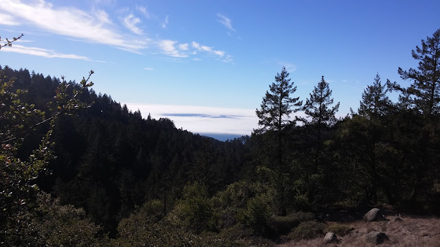
Shortly after that, at the Pantoll Ranger Station, the route forks off on Pan Toll Road. Apologies for the overuse of superlatives, but the views were getting ever better. I was now high up enough to get glimpes of San Francisco, the Golden Gate Bridge, and the foggy ocean all at the same time!
 |
| The view that has it all |
 |
| Climbing, climbing, climbing |
At the next intersection I had to decide if I wanted to take the dead-end road to the eastern summit of Mt. Tam or just continue on the loop. I had plenty of daylight left and was feeling great—so on to the summit I rode. This involved a good bit of up and down, including a mean ramp just before the parking lot at the end of the road. I was happy to see functional water fountains at the parking lot and took a fifteen minute break at a picnic area with yet more great views. I didn't have a lock and therefore skipped the walk to the actual summit.
 |
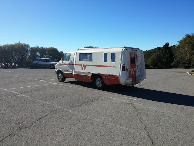
| At the East Summit parking lot. The couple traveling in this 1970s "Winnie Wagon" later ran into me again and asked me for directions, |
 |
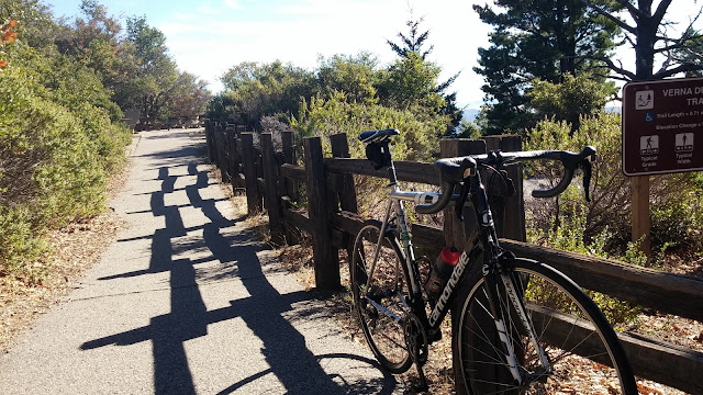
My laterally stiff yet vertically compliant stiff bike |
Back at the fork, I now turned right, knowing that from here on the ride would be mostly downhill. My legs certainly appreciated that prospect. However, between lingering memories of my recent crash and, more importantly, the skinny, stiff, overinflated tires on a bumpy road, descending wasn't as much fun as it should be.
 |
| Stinson Beach |
 |
| Ridgecrest Road |
Once again. the scenery provided ample compensation. First on an open ridge with views in all directions, then on a twisting road through tall trees. At the bottom of the descent, the route traverses Alpine Dam and then follows the shore of
Alpine Lake. I was amazed how quiet it was down here, with hardly a car or person to be seen.
 |
| Alpine Lake, seen from the dam |
All the climbing had taken its toll, and I had to sit down for a bit and eat the last of the three Clif Bars I had brought on the ride. Fortunately, after a steep but short uphill, it was all downhill again. Between tall redwoods and ferns, Bolinas-Fairfax Road wound downhill in twists and turns.
 |
| One of the switchbacks on Bolinas-Fairfax Road |
As the road left the forest, I was greeted by the view of a big golf course, whose lush green color stood in marked contrast to the brown and yellow tones encountered earlier on the ride. Drought-shmought...
 |
| Indoor bike parking at Gestalt Haus |
A final downhill led me right into the town center of Fairfax, where I made a much needed stop at
Gestalt Haus. Gestalt Haus is very much a biker bar, but one catering to bikers of the non-motorized variety. You can roll your bike right in and hang it on a wall rack (which proved immensely convenient given that I didn't have a lock), and there were plenty of fellow cyclists enjoying beers and brats.
 |
| Enjoying a vegan sausage and a Ballast Point Sculpin |
I later realized that the
Marin Bike Museum and MTB Hall of Fame was only one block away from the Gestalt Haus, but I guess I wouldn't have had time to visit anyway. To get back to Sausalito, I followed well-signposted bike routes, which weren't particularly exciting but mostly pleasant to ride on. By the time I got back to the Golden Gate Bridge, the sun had started to slowly set, and fog started rolling into the bay. Just amazing, or in the words of the local cyclist who pulled up next to me to also take a picture: “This never gets old!&rdquot;
\
I returned the bike at the shop after almost exactly 100 kilometers (62 miles) and 1800 meters of climbing. 10/10, highly recommended!


