Showing posts with label Route Verte. Show all posts

Monday, January 6, 2014

Eastern Townships 2013, Day 7: Yamaska River National Park to Montreal

< back to day 6
We successfully made it through the night without any further wildlife incidents -- or at least none severe enough to wake us up. The final day of our trip had arrived, with almost 100 kilometers left to go back to Montreal. Before hitting the road, however, we were about to switch our mode of transport from pedals to paddles.
Packed up and ready to go
Bathroom selfie
Because it was a weekday, all equipment rentals at the park were half-off, providing us with an opportunity to explore the reservoir by canoe. We picked up the paddles and life vests at the info counter and biked to the beach
Never bike without your helm...er...life vest
Much to the biketopus's amusement, my paddling skills continue to be, well, a little underdeveloped, but with the help of Captain Biketopus we safely made it out onto the lake and back. Other than one other canoe and the occasional bird, we had the reservoir all to ourselves.


The hour passed by swiftly and I was glad to have steady ground under my feet again. It was time to get back home! We followed the Yamaska River downstream to Lac Boivin. On an observation tower we stopped for a second breakfast, bird watching, and looking back towards the mountains that we had ridden over just a few days ago.
High above Lac Boivin
The ride back to Montreal was rather uneventful. Except for a couple kilometers between Granby and Saint-Cesaire we backtracked the route we had taken on day 1. In Chambly we passed by the preparations for a large beer festival -- unfortunately we were one day too early -- and stopped for ice cream. I also quickly went into the restaurant where I had lost my gloves and lock on day one, but no luck.

Route des Champs turning from asphalt to gravel
From Chambly, there were only about 30 kilometers left to go, all flat, but our legs and butts were increasingly tired. We made a final stop at the Saint-Lambert locks on the St. Lawrence and at almost exactly 100 km we arrived back home. Hooray!
Home in sight!

We can do it!

Monday, December 16, 2013

Eastern Townships 2013, Day 6: Frelighsburg to Yamaska River National Park

< back to day 5 forward to day 7 >
I woke up early to a sunny but misty morning. As it wasn't yet quite a safe time to wake up the biketopus, I spent some time making a fire and watching hectic campground staff cleaning everything thrice in preparation for an upcoming inspection that morning.

Over breakfast, we discussed the plan for rest of our trip. It was clear that we were too far behind schedule to do the original route, especially since our legs were still feeling tired. We had offers from two different Warmshowers hosts but one would have been too close, the other too far away. In the end we settled on riding north to Yamaska National Park near Granby today and then have a long but flat day back to Montreal the day after.
After a few flat kilometers back into Frelighsburg, we were served a mean hill for breakfast. According to the sign on top, it was a 10 per cent grade, but compared to what we had done on previous days it didn't feel too deadly.
The mountains of the Eastern Township were still visible in the distance but our route significantly flattened into gently rolling hills.
In Dunham we rode past this lovely looking microbrewery/brewpub. Unfortunately, they were closed and at any rate it still would have been a little early for beer.


Instead of beer, we had bread and pastries from a local bakery next door as a second breakfast. I also picked up a paper map and further refined the remaining route to Granby, trying to stay away from busy roads as much as possible.
That plan worked out very well and for the rest of day we would encounter only few cars on these pretty country roads.

Past Cowansville, we turned east for a bit, following one arm of the Yamaska River (somewhat confusingly, the river consists of several tributaries, all having Yamaska in their name). At the turn-off I had spotted a sign for two covered bridges and I thought they would probably make for a good lunch stop. We were riding along for a bit and I was afraid we might have missed the bridge, but finally we saw the sign and shortly thereafter the bridge, Pont Balthazar. Now I must say that I don't quite understand the North American obsession with covered bridges, but this one's location was stunningly beautiful, right over some rocky rapids.


When looking for that perfect lunch spot, I noticed what looked like a turtle in the water below. It was so big, however, that I first couldn't believe it. To a German, turtles are things that live in zoos or on the Galapagos Island, and even while living in the US I had only ever seen modestly sized ones. This one, in contrast was about 40 cm, lazily lying in the water between two rocks.

What more can you ask for for a lunch break -- covered bridge, lovely scenery, amazing wildlife.


Our route continued on tranquil roads before finally we had completed our loop and met up with the Route Verte where we had been riding on our second day.
After passing through Granby again, this time we kept left and headed towards the National Park. Whereas Mont Orford National Park fit the stereotype of a place of untouched nature very well, the park in Yamaska featured landscape clearly shaped by humans. The Yamaska River (yet another tributary) is dammed to form a large freshwater reservoir, surrounded by the park.


When entering the park, we saw signs that there currently was a blue-green algae bloom in the reservoir. No swimming for us -- or anyone else. As a consequence, the park was pretty empty. Instead of taking one of the cyclist camping sites we were assigned a regular spot in the woods. Before the sun set we took the opportunity for a short hike through the forest. As we walking along on a narrow trail,  I suddenly spotted a porcupine sitting in a tree. Mr. (or Mrs.?) Porcupine and I were equally startled for a moment -- seeing a porcupine in the wild was another first for me -- and the biketopus was startled by me making a jump to the side and being like "Whoa! Porcupine!"

Unfortunately, we weren't quite done yet with our wildlife encounters for the day. After dinner, I took a trip to the bathrooms to clean our dishes and do laundry. The biketopus stayed at our campsite and had an unwanted visitor -- a skunk! We had seen them before but this particular one was clearly more curious than afraid of humans and decided sniff the biketopus's toe. Understandably, she was not too thrilled about that! Fortunately, it all ended well, even though the skunk returned later at night, while we were sleeping in the tent to check out my bike shoes under the tent's fly. Well, what can you say: they're black and white and they sure did smell!

< back to day 5 forward to day 7 >

Tuesday, September 24, 2013

Eastern Townships 2013, Day 4: Lennoxville to Mansonville

< back to day 3 > forward to day 5
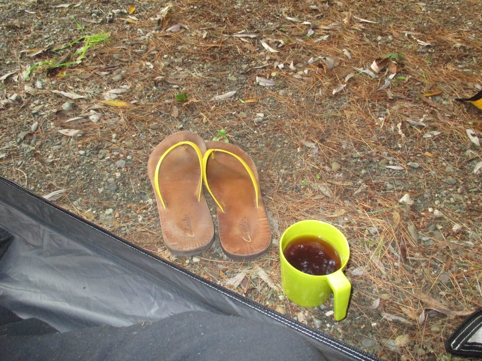
Until now, the weather on our ride had been perfect: sunny but not too hot during, and cool but not cold during the nights. During the night at our motel, however, we could hear the first rain, and when dragged ourselves out of bed it was very gray outside. It wasn't exactly raining, but the air was oversaturated with water, leaving fine drops on our skin and clothing on the way to breakfast. Lennoxville not only sports a fine brewpub, but also a great coffee roaster. We had spotted the place the previous night and already decided that it looked like a perfect place to have breakfast.
The barrista was very nice and started geeking out with me about cold brew coffee, but he also seemed slightly overcaffeinated and totally forgot the biketopus's cream cheese bagel. The bagel and our drinks were very tasty, however, and we would definitely go there again.While having our breakfast we figured out our plan for the day. We decided to follow the Route Verte back to Magog and then either call a potential warmshowers -- a couchsurfing for cyclists network -- host in Mansonville or find a campground somewhere near Magog.
The weather forecast predicted showers throughout the day and possibly heavy thunderstorms in the late afternoon. For now, it was merely grey and humid. Out of Lennoxville the Route Verte follows the Massawippi River on what appears to be a rail trail. For the first time, we were slightly chilly in shorts and short sleeve jerseys -- but not cold enough to actually add another layer. The trail was almost completely empty, but after switching to the road near North Hatley we encountered two fully loaded cyclists. This was a rare occurrence, as the vast majority of cyclists we had encountered on our trip so far had either been people on day trips or maybe credit card tourers.

North Hatley is located on the northern end of Lake Massawippi. Whereas our route so far had been as flat as is typical for a rail trail, the road out of Hatley was the first of many mean hills still to come today. First on highway 108, then on a short, steep and wholly unnecessary section of trail, and then on a muddy dirt road we climbed from lake level up the surrounding hills. The dirt road was closed due to construction but we fortunately could get through. The landscape was a mix of forests and a bit of agriculture, and we didn't encounter many cars or people. We descended on a dead straight dirt road with just the right gradient to go fast but not too fast.

After crossing the highway we were on a trail again, traversing a dense forest before ending up at a municipal park. There was a mismatch between where my GPS wanted us to go and where the Route Verte signs pointed to, and after a short Clif Bar break we decided to go with the signs. This turned out to be the right decision and soon after we were back at where the two routes into Sherbrooke split.

The way back to Magog was uneventful except for some mosquito attacks when we were trying to take a nature break in the forest. We followed the same way as yesterday but took a shortcut on the main road into Magog to avoid some Route Verte stupidities. Just in time for lunch we were back at Marché Vegetarien. The promenade on the lake today was much emptier than yesterday. We finally had to put on our rain jackets to protect us from the cold wind blowing over the lake. It was still unclear what the day's final destination should be. It was well past noon and to Mansonville it still would be a long and hilly way. Calling Jacques, our potential host, settled the matter: we would stay with him tonight. He was very friendly on the phone and promised us a bed, dinner, and beer -- "that's the Eastern Townships way." To my question if there were many hills between Magog and Mansonville he just laughed out loud...
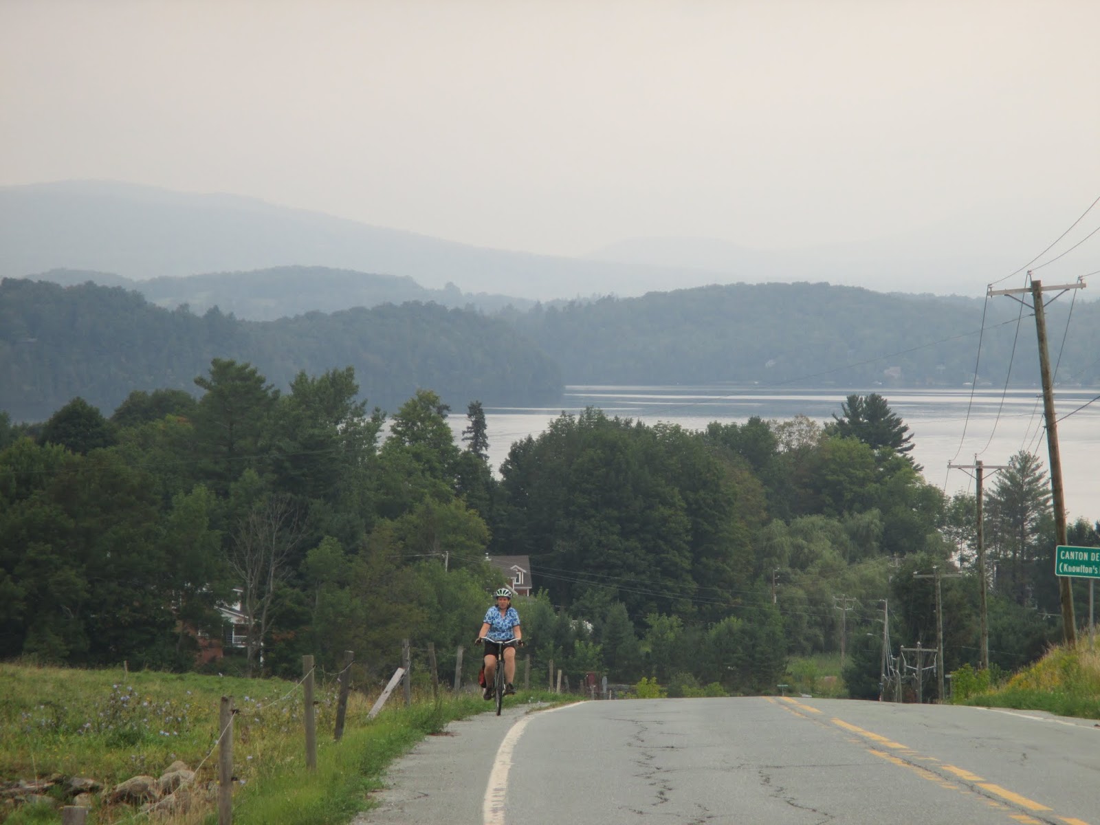
And yes, there were more than enough hills. Right after turning off the Route Verte, a big hill appeared in front of us and for the rest of the day the elevation profile looked like a sawblade. For the first time on our tour we were no longer following a bike route but rode on gorgeous country roads. To me this is the best kind of riding. Traffic was minimal and it was finally dry enough for me to pull out my camera.
We were now headed straight south towards the Vermont border, following the western shoreline of Lac-Memphremagog.
Other than cows, small family cemeteries, and a beautiful landscape, there isn't much.

The sky looked as if it was about to start raining any minute, but amazingly the weather held up all the way to Mansonville.
At 5pm we quickly called Jacques to let him know that we were getting close. To our delight, he told us that from here on it was only more climb and then all the way downhill into Mansonville.
Mansonville is a cute little town that I had ridden through previously on my 300km brevets. We had been warmshowers members for a while now and hosted several bike tourists in Montreal, but this was the first time that we ourselves stayed with someone from warmshowers. Jacques and his wife Allison were great hosts! They provided great food, beer, a cute dog, and excellent conversation. Jacques, amongst other things, works as a guide for a bike touring company and had just gotten back from a ride in the Lower Saint Lawrence region.
Shortly after dinner, we exhaustedly and happily passed out in our comfy bed. This had been the hardest day of the tour!


> forward to day 5

Saturday, September 21, 2013

Eastern Townships 2013, Day 3: Mont-Orford National Park to Lennoxville

<  back to day 2 forward to day 4 >

The night in the tent was quite a bit warmer than the previous one. We had closed both sides of the rain fly, which probably was a good idea not just for temperature regulation but also for keeping wildlife in check. Campground staff had warned us about a raccoon problem and we had spotted a couple of them before going to bed. Our neighbor, who slept in a hammock, told us in the morning that the 'coons had kept him awake for a good while when they were fighting over a plastic bag and ran around his bike and hammock. We hadn't heard any of this, me because of my preventative use of ear plugs, the biketopus because of her ability to sleep through that kind of stuff after a long day on the bike.

After my nice evening swim, I definitely wanted to make sure that the biketopus would get to see the lovely lake as well, and so after packing up we headed down to the lake instead of back up to the Route Verte. It was still very empty and quiet at the beach, but we knew that there was a long day ahead of us and we got going again. According to the map, the main park road woul
d intersect with the Route Verte after a few kilometers and so we decided to spare ourselves the potential up and down of the trail. The park road was very quiet still and the scenery was really lovely.
Morning at the Lac-Stukely beach


Our destination for the day was Lennoxville, a small town just outside Sherbrooke, where we had booked a motel for the night. Sherbrooke is quite a bit lower than the Mont Orford Park, but this by no means meant that it'd be a nice downhill all day. The climbing started as soon as we got on the Route Verte at the Étang aux cerises, another beautiful lake in the National Park.
On the park road
Étang aux cerises -- not exactly a swamp
Through the dense forest of the National Park the Route Verte meandered up and down. The climbs weren't long, but some of them were steep enough to force me off the bike for the first time on this trip.
Leaving the park
Once we had exited the park, we got a short reprieve from the up and down. First on a gravel trail, then on a stunning dirt road, we zoomed downhill to the small town of Orford.

Perfect dirt road
We had a second breakfast at the local grocery/prepared foods store. The following 10 kilometers would have made a great exhibit for a bike-infrastructure-planned-by-non-cyclists blackbook. The route awkwardly looped around Orford, and while doing do continued to include every little climb possible. More than once did we fantasize about putting one of the Route Verte planners on a fully loaded touring bike and making them ride the route 5 times in a row...
Huh, now we're heading towards Mont Orford? I thought that's where we came from...
Fortunately, the great weather and scenic landscape mostly made up for the planning SNAFUs and after not too long we reached Lac Memphremagog and the town of Magog on its nothern tip.
Is Lac Memphremagog's Nessie called Messie?
It was time to have lunch again, and we were happy to spot a "Marche Vegetarien" right next to the lake promenade. It was a little suspicious that a vegetarian market would include a butcher's and a fish shop, but hey, they did have a good selection of tasty veggie foods.


Our lunch spot was a picnic table overlooking the lake that stretches all the way into northern Vermont.

The view from our lunch spot

The route out of Magog was mostly unremarkable. A little bit of gratuitous up and down, some riding through industrial areas, and then long, straight gravel trails through the forest. After passing Lac Magog, much smaller than Lac Memphremagog, the bike route forks: The official Route Verte crosses the Magog River and leads south to Lac Massawippi before entering Sherbrooke from the southeast; the other route follows the Magog river northeast into Sherbrooke. After the previous days' experience with the Route Verte, we suspected that the former option would not only be farther, but might also include who-know-how-many hills. Therefore, we decided to take the easier option this time and save the Route Verte for tomorrow.

The ride into Sherbrooke was mostly uneventful and because of the proximity of the river very pretty. A friend of ours who spent a lot of time in Sherbrooke for work had warned us that the city itself was rather boring. The view from the cycling path, however, made it seem pretty nice, though. Sherbrooke is located at the confluence of the Magog and the Saint-François rivers, and this is also where the Axe de la Magog and the Route Verte meet together again. To get to our destination, we followed the Route Verte and the Saint-François southeast for about ten kilometers until we reached the campus of Bishop's University.
You can't see the sign, but this is a sewing atelier. The biketopus was jealous!
Bishop's is one of the three primarily English language universities in Quebec and the only one outside of Montreal. Consequently, Lennoxville had a pretty anglo feel to it. At our hotel, La Paysanne, most of the cars had Ontario license plates -- parents dropping off their children for the new school year. After having made ourselves a little more presentable and me going on a short reconnaissance ride to make sure they were open, we walked into the town center to what is the oldest brewpub in Quebec, the Lion d'Or / Golden Lion. On their lovely patio we enjoyed some beers before getting some grocery store foods for me and a gigantic poutine for the biketopus, to be eaten in our comfortable bed.


forward to day 4 >